Lake Havasu City AZ Nov 17 -24

We thought it would be nice to spend a week somewhere and rest from traveling. Lake Havasu City AZ was our choice. Campbell Cove RV park has 124 RV sites on a 2 acre parcel of land – not much room between sites. We thought it strange that with all the open space the desert has to offer everyone wants to be crammed up! And we hardly saw anyone – seems everyone wanted to stay inside their RVs. But I did manage to make one friend. Nala is a sweet girl with big cheeks and little ears. She was the dog next door – a Sharpei mixed with something else. Her people went out one afternoon and evening and we could hear her in the RV whining and scratching at the windows. I could hardly stand it and can’t imagine what kind of mess her people came home to!

Thanksgiving is a big deal here. Cashiers would wish me “Happy Holidays” and I would wish them “Merry Christmas” but it turns out that the holiday they referred to was Thanksgiving. Oh well. The RV park invited the campers to a potluck on Thanksgiving Day – they supplied the turkey and ham and everyone else brought the fixings. We took part but didn’t really connect with anyone.

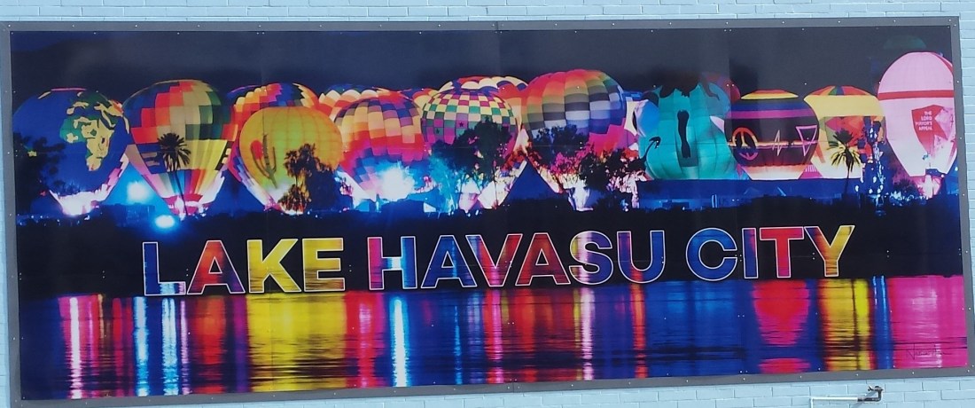
Lake Havasu City has quite a history. It’s a long story, but one we found to be very interesting. The south west desert needs to be watered so in the 1940’s Parker Dam was built on the Colorado River. It created Lake Havasu (“Havasu” means green blue water, and that is its color – beautiful). The lake is in the middle of the desert and there was no city there. Copper was mined along the river during the Gold and Silver Rush days and it was farmland to Mojave Natives. When the dam was built, water covered the mining site which ended the copper mining and the crops grown by Native American farmers – a typical story.

Enter Robert McCulloch, entrepreneur known for his chainsaws and motors, who happened to be married to Barbara Briggs, daughter of Briggs from Briggs and Stratton engines. He bought 26 square miles of land around the lake for $74.00/acre. In the 1960’s London England put the London Bridge on the auction block. Built in 1830’s across the River Thames it would sink 1 inch every 6 years. After 130 years it was unsafe to drive on, but the Londoners didn’t want it destroyed and forgotten – it was the first bridge across the River Thames that was made of granite, not wood. So the largest item to be put up for auction was bought by McCulloch for $2.5M and the sale included the unique lampposts, molded from French cannons captured during the 1815 battle of Waterloo.
Its bricks were meticulously numbered as it was dismantled, shipped to Long Beach, CA and carted to Lake Havasu. Mr. McCulloch then had the bridge reconstructed on dry land on Pittsburgh Peninsula. Everyone thought he was crazy. But he was a genius. After the construction he dug out the dirt allowing Lake Havasu to flow under it, making the peninsula an island. The total cost was $7M. There was lots of granite left over and he sold the remains to artisans and headstone masons. He recouped his $7M and more. He partnered with C.V. Wood Jr, the builder of Disney World to plan a city. He flew in prospective land buyers, wining and dining them at his own expense. And many purchased land from him. The first year he made $100M.

Today Lake Havasu City is a wealthy city for the wealthy, boasting 55,000 residents which attracts upwards to 750,000 visitors every year. It is a destination for water sports, ATV lovers and classic car enthusiasts. It is a beautiful city that has much to offer. If you like lots of heavy noise (big-block v8 boat engines, big car engines and lots of ATV traffic), water sports, small living spaces and spending money, Lake Havasu City is a spot for you.
We took a boat tour of the Lake where we learned the history of the city and the bridge and floated over where the copper mine was located. Other interesting things about the bridge – it bears the marks of machine gun fire and bombs from German air attacks during WWII; there are thousands of padlocks on both sides that couples put there declaring their love for each other – the locks bear the date and/or initials and then the key thrown into the water.

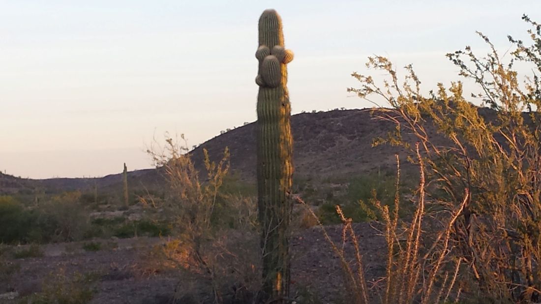
On our final night they lit 500,000 Christmas lights down by the bridge. Americans love to do it up big for Christmas. There is so much material wealth here in the south-west it makes us feel a bit uncomfortable. I know that we, too, are wealthy by many standards but our old RV parked between a bunch of $250k luxury RV machines made us feel out of place. “America first” is good for Americans but with so much wealth around the country can afford to be more generous, especially with the poverty we have seen on Native American reservations. We were happy to head out to the desert again, to the quiet solitude and natural beauty.


Home in the Desert – Nov 12-17

Well Glenda and I discovered we love the Desert! Even after the beauty of the California Coast we have both been captivated by the Arizona desert. It may have to do with the Saguaro Cactus – they are an amazing and sometimes hilarious iconic Arizona desert tree. Like people they come in all shapes and sizes and I’m sure Bert the Muppet was fashioned after a saguaro. They get to be very old and are as tough as a boot – even a little one is well rooted and basically immovable. I’d love to take one home.

We’ve been pretty wary of rattlesnakes what with all the signs, warnings and horror stories we heard so far. So we went to Cabelas and bought snake boots! Come on snake! Haven’t seen one yet but we are ready. They are kind of an all around outdoor waterproof stompin’ boot so we can use them in NS for stompin’ something. It is deer hunting season here so we wore yellow for our desert hike.

We spent several days at Painted Rock Petroglyph Campground and saw some petroglyphs left by some ancient people on the old southern Arizona trail that follows the Gila River. It was some sort of sacred site as there are none others around that area. It is thought it was a place for leaving messages as well as mostly unknown symbols. A typical day for us in the desert is watching beautiful sunrises, Bible reading with great coffee, walking, biking or hiking, Glenda baking in the tiny kitchen, flyovers by fighter jets, bbq every night and wonderful sunsets and night sky. Days here are almost as short as they are at home, which is a surprise since we are at 33 latitude. But oh the sun – sunny every day and temps between 70 and 80 – I love the old Fahrenheit scale! 80f just seems warmer than 26c. It is incredibly dry as well – in fact the humidity today is 11%!

Another thing about the desert is the unexpected greenery. There is plenty of rock, gravel and sand but more trees than I expected and the very unexpected fields of alfalfa/hay/grain. We biked by a ranch that had a pump feeding 3 large water pipes into a concrete trough like a small river that irrigates alfalfa fields. Almost half of the water for agriculture comes from the Colorado River irrigation system which is well over 200 miles away – the rest from wells/aquifers. I have to wonder how sustainable that is in a state with severe drought and scorching heat. The ranches are huge and the number of cattle is amazing. Next we are off for Lake Havasu City for a week.


Ventura Highway to Phoenix Nov.7-11

We followed the coastline from Morro Bay to El Capitan State Park (which is just north of Santa Barbara), admiring the beautiful beaches and coast as we went. Our campsite looked out over the Pacific with a view of 3 oil rigs just off shore. We strolled the beach and I found a really cool shell and saw different kinds of shore birds foraging for their dinner. The lights on the rigs shone beautifully after dark like beacons in the night. We met our neighbor, Geri, and had supper together the second night we were there. Geri and her husband, Robert, (both retired for a while) sold their home in 2010 and became full time RVers, traveling wherever they wanted. In 2015 Robert died suddenly as a result of a post-surgery blood clot. Geri is a pleasant woman and brave to drive a 30 ft RV pulling a car behind. She travels with 3 cats, as well as Robert’s ashes and the ashes of 2 other cats and those of a dog. We also met Lisa and Tom. Lisa is a nature lover who paddle boards in the Pacific among sting rays, tiger sharks and dolphins when she can. She showed us a relative of the star fish – the brittle star that lives in washed up kelp forests. Meeting people is so much fun.

Next we stopped in Santa Barbara for a look around. Sat at the beach for a little bit and headed downtown. But RVs are not permitted to park downtown so we just made our way toward Phoenix. The landscape was filled with lemon groves, almond groves and strawberry fields. The mountains on our left were beautiful and we could see we were coming into the desert again.

(Doug: We drove down the Ventura Highway with the old America song from the 1970’s of the same name playing as we drove. It was just like the song said, with the Pacific Ocean dazzling beside us. We played our Mamas & Papas cd as well. So much of the music of our youth came from here and it brings back many memories and places the songs are about.)

As we began our drive around L.A. we saw a 6 Flags roller coaster park in Santa Clarita. We had always wanted to take our kids to one when we traveled years ago, but couldn’t afford it. The traffic on Hwy 210 that skirts L.A. is absolutely crazy. Seven lanes of every sort of vehicle, always changing lanes, in a hurry to get to wherever. I hung on for dear life and prayed a couple of times. And I wondered, “Who needs 6 Flags? Just rent an RV and drive the 210. That should do it!” And the wind – called Santa Ana winds – was unbelievable. Doug fought hard to keep the RV in the proper lane as he drove with others who bobbed and weaved and hogged the road.

I wondered something else, “Why are powerful, potentially destructive phenomena named after women?” And it came to me – we are the movers and shakers, and if something can be said of Santa Ana winds, it would be they will move and shake anything. The winds are gusts of up to 40 – 60 mph that come over the mountains flowing to the desert floor, hitting from the side. They will make a person stand up and pay attention. We are thankful the Lord got us through.

(Doug: I know why powerful, destructive phenomena are named after women – Lol!)

Ally and Mike spent 5 days in the Malibu area after our Christmas celebrations. We passed through there on Thursday. On Friday morning we heard that a forest fire had jumped Hwy 101 at Thousand Oaks and that people were ordered to evacuate. Thousand Oaks is just a little NW of Malibu and we got a text from Ally saying they were safe but they evacuated and could see the fire. She also told us there was a shooting. I thought she meant someone shot someone else, but she was talking about the mass shooting at a bar in Malibu where 13 people died. Again, we are thankful the Lord kept us all safe.

On Friday we arrived at Quartzsite AZ. The town has a population of just over 3,000 but that number swells to over 500,000 in January until it gets hot in the Spring of the year. Why? Because Quartzsite is the boondocking capital of the USA with the creation in 1983 of La Posa Long Term Visitor Area (LTVA) to accommodate snowbirds. The LTVA is over 11,000 acres of wilderness that allows travelers to set up camp. Cost is $40 for 14 days or $180 for 7 months. And it creates business for the town – tent vendors set up shop and sell anything from groceries, hardware, antiques, clothing, RV supplies (everything really). It’s the biggest yard sale I have ever taken in. We stayed one night (but will return later this month), because we went to Phoenix for a Nascar race. I will let Doug give details on that!

(Well I could hardly keep Glenda from busting she was so excited about the race. We had a great day, tons of people and Rv’ers, lots of American military honors for their Veterans Day and the fighter jets flyover. It was quite dramatic as the race eliminated 4 drivers from the final championship race next weekend. Kyle Bush won, just as he did last Fall when Shawn, Aiden, Pat and I went to New Hampshire.)

We will be spending the best part of the next 2 months in the desert and we want to do lots of hiking. It is so beautiful, although very harsh. Doug tried to calm my fears about snakes by telling me “Rattlers don’t like it too hot or too cold and don’t want to be where there are a lot of people.” That didn’t help any because it sounds like that is where I want to be too. So I think I will be shopping for some snake/cowboy boots!

The weather is perfect. I can’t remember when we saw rain last. The sun is powerful and it can get hot in the daytime. It can get pretty cold at night too – still using the wool blanket and heating pad. It was wonderful to share time with Ben, Ally and Mike, but my heart yearns to see the rest of my family. Although we are enjoying a great adventure, I miss home. The wound left by the events of the past year runs deep and I miss Jenny horribly. The ebb and flow of life is a dichotomy – the yearnings on one hand and the joys and fullness on the other. Reminds me of what Paul wrote to the Philippians, “…I have learned in whatever situation I am to be content…I have learned the secret of facing plenty and hunger, abundance and need. I can do all things through Christ Who gives me strength.” This is the journey and the challenge.

(Doug: when we were with Ben, Ally and Mike for our family Christmas we shared some of our favourite memories about Jenny. It was both a happy and sad time of reflection. Ben said that the last day he was with her when she visited him in Calgary last summer he took her to a batting cage before she left. He said she was so full of life and free – that is a nice picture we won’t forget.)

Now, onto the Sonoran Desert and Gila Bend, AZ. What an interesting name for a town…


Early Christmas in Morro Bay Oct 29 – Nov 6

We left the Redwoods on Monday morning around 10 AM. It was chilly – we could see our breath! The traffic became heavier the closer we came to San Francisco. But there was still a lot of countryside. Vineyards and cattle ranches.

The population of San Francisco proper is close to 900,000 people. And they have built their houses so close together they can all hold hands with each other. It is a picturesque city, though. We thought about walking on the Golden Gate bridge before crossing it, but decided to just drive it. Its span is over 2700 metres and it takes a pretty picture. We enjoyed some local seafood on our way through to Pascadero State Park where we boondocked for the night. The sight of the beaches south of San Francisco was something to behold. The highway followed the coastline alongside a swath of sand averaging around 750 feet that met the most wonderful, power-packed surf.

Our campsite for the next two nights was Sunset Beach State Park. The campsites are separated from the beach by huge dunes covered in scrub. After we set up (not that there is much work to doing that!), we climbed the steep embankment and walked the wide beach below, enjoying the pounding surf, even dipping our feet in. It was pretty cold (freezing, actually). As we climbed back toward “home”, we stopped to catch our breath. High on the embankment we looked out on the vast expanse and were greeted by a wonderful show of a group of whales just off shore – surfacing as they enjoyed their dinner! What a treat.

On our beach walk the next day we encountered a huge sea lion that had beached itself. A woman we met said it was dying, but it looked healthy to us. So I googled it. It seems that sea lions will beach themselves sometimes to rest. Who knew? The sunset was spectacular – again! On the way back “home” we saw a screech owl in the twilight, which hindered us from getting a good picture.

On Thursday we drove to Monterey and met Ally and Mike at Fisherman’s Wharf. It was so good to see them and we enjoyed a long walk on the beach. We will meet them again as well as Ben in Morro Bay for the weekend. The landscape along our way isn’t the same as Nova Scotia’s, but it is very similar – rolling hills and trees. There are lots of vineyards, strawberry fields, brussel sprout crops complete with a huge group of laborers. Reminds me of many fields at home with temporary workers.

Ben arrived at Morro Bay where we were camped late afternoon on Friday. We camped at Morro Dunes which is situated almost on the wide sandy beach. We only had to walk across the road and over the dunes to enjoy it’s wonder. Lots of sand dollars littered the beach. I gathered a great bunch and Doug asked what I was going to do with them all. I simply said I was going to go shopping at Davey Jones’s Locker. After Ally and Mike arrived we enjoyed a BBQ supper. On Saturday we wondered around the waterfront and around Morro Rock, a volcanic plug which stands almost 600 feet at the shoreline. There were still lots of tourists around and plenty of cute sea otters. Later in the afternoon Ben and I played in the surf for about 15 minutes – it was exhilarating (and freezing). Our young folks shared an air B&B and we all gathered there to celebrate Christmas, complete with turkey, ham and lots of fixings, and of course a gift exchange. It was so wonderful to meet them here and have an early Christmas. As Ben reminded us, it was our first family vacation since 2005.

On Sunday we walked around San Luis Obispo and Pismo Beach. Both are quaint little towns with lots of touristy shops. Pismo Beach has a huge waterfront pier that extends 1370 ft over the water at 25 ft high. We saw lots of people with fishing poles and watched as a group of surfers rode the waves below. Ben bid us goodbye Monday morning after breakfast at a Morro Bay French bakery. He drove back to San Francisco to catch his flight home to Calgary. The rest of us decided to drive up Hwy 1 to Hearst Castle and make a loop to Hwy 101 back to Morro Bay. We didn’t go into the castle and after a long time on the twisty narrow road discovered that we missed the road to Hwy 101.

But we got to see an Elephant Seal colony along the way. Hundreds of them lined the beach. Up to a hundred years ago they were hunted for the oil in their blubber. Numbers were reduced to less than 50. However, a hundred years of protection has seen the numbers increase to over 250,000. We did get to Big Sur – much like the Cabot Trail but more of it. On our way back we caught a glimpse of some zebras close to the castle area – ancestors of the zebras brought there by Wm. Hearst while he was developing the estate in the 1920’s.

The weekend was definitely the highlight of our trip – we had a really great time with the kids. And tonight, as I write this, I am enjoying the roar of the great surf – music to my ears. Another highlight is the great weather – sunny every day with temps between 70-85F. “It never rains in California” – as the old song goes. Ally and Mike are going to LA for a few days before returning to Iqaluit and the cold. Next we are heading to the Santa Barbara area for a few days and then on to Phoenix for next Sunday’s NASCAR race.


Nevada to Northern California Oct 21-28

After worship with the folks in Overton, we headed to Las Vegas where I did the laundry and Doug watched football (not much changes even while traveling 😊). Then we found a parking spot at “Camp Walmart” in North Las Vegas. We thought about walking the “strip”, and if driving there wasn’t so difficult we would have gone. And many we know told us we should, that the lights and sights are beautiful. And I am sure they are. But when we drove through on the hwy I could see the desert contrast against the city, and the thought came to me – God made all the natural beauty we have seen and humans have put a great city right in the middle of it. And for all the “citified” people we know, we know they would love it, but it wasn’t calling to us.

As we traveled north on Hwy 95 we passed through a lot of small towns that time has forgotten. One is the old mining town of Tonopah NV. Abandoned businesses and houses, broken down homes with folks still living in them. I thought of those businesses and homes. At one time they were someone’s hope and future. Where are those folks now and what of their dreams? The landscape is so harsh and poor. I wonder if their lives are like that. We saw wild burros and a few cattle and wondered how they stay alive – not much to eat and we never saw water. The western Nevada landscape is hot, extremely dry and foreboding, yet beautiful with rolling high hills, mountainous terrain and plenty of ghost towns.

We also drove through Hawthorne. It is a small town built around a US army Ammo plant. The landscape is marked with tons of bunkers that house old war ammo. Sometimes the army detonates some of it. The girl at the gas station told me that the town shakes when they do.
At around 7 PM we arrived at Fort Churchill State Park in NV. After getting set up we went for walk in the moonlight, hearing the yipping of coyotes. Quite a difference from Vegas! The fort has its story as well. Three white men kidnapped 2 Native girls and took them to William Station. The tribe rescued them and burned the station. 105 vigilante white men embarked on a retaliatory, vengeful hunt only to have 75 of them killed during the attack. The US army then attacked the natives, killing a bunch of them and decided to build Fort Churchill. Not only was it built to protect the area from Indian raids, its purpose was also to protect Pony Express Riders and to keep southern rebel sympathizers at bay.

Virginia City was to be a little detour. We wanted to go because we both watched Bonanza as kids (didn’t everyone?). The flame at Virginia City on the map. What we didn’t realize was that the road we took to the city was a treacherous, mountain-climbing, white knuckle, look over the edge with no guardrail kind of road (and we were told all roads to the city are the same). No turning around now – really. The city is on the top of a mountain in the middle of nowhere. And a city it is! The main street is lined on both sides with many original buildings (wooden sidewalks, overhang rooves, and store front signs) – shops, saloons (lots of those), museums and restaurants. We didn’t notice a grocery store or a bank. The town had a major fire in 1869. It was a mining town and when the mine closed cowboys took over. Bonanza wasn’t even filmed there (except for bits of 2 episodes), although the Ponderosa is located not too far away where most of the filming was done. It is a touristy and even at the end of October was overrun with people. And we were surprised to find that it is the hometown of Mark Twain. Then we had to make the descent! We figured that Doug could drive just about anywhere after that. We made camp at Lake Washoe State Park.

In the morning we seen a guy looking in the garbage across from our campsite. I thought he was looking for bottles to cash in. I had an empty one that was going out and when I offered it to him as I dumped our garbage he wasn’t at all interested. I quickly realized he was digging for food. I hurriedly got a few food items together and gave them to him and he disappeared. I wanted to give him more but couldn’t find him. We went for a walk around the park. The State parks are so well cared for and are beautiful.

While we were in Santa Fe we met a couple of believers, Terry and Anita, from Nevada City CA who had invited us to contact them if we were going by there. We did and they invited us to spend the night. Terry sent us directions from the border to their place. Donner Pass is 7200 ft high and we had to travel over it to get to California. Terry’s directions included traveling on Hwy 20. The descent on Hwy 20 to Nevada City is not for the fainthearted! It made the drive to and from Virginia City look like child’s play. Then we missed our turnoff and used the GPS. Big mistake. By that time it was dark and the roads to our destination were more of the same. The heart wrenching drive was worth our visit with Terry and Anita. They are a delightful retired couple – she a nurse, he an administrator for hospitals. We had a fantastic evening, talking near midnight about a wide variety of subjects. They treated us to breakfast at a quaint little café the next morning. Who knew that making friends while traveling would be so much fun?! We feel it will be a lasting rewarding spiritual friendship, one we will cherish for years to come. Our visit is definitely a highlight of our travels and we thank God for the fellowship we enjoyed.

Terry assured us that Hwy 20 to Ukiah wouldn’t be difficult. But that wasn’t our experience. Maybe because their RV is quite a bit smaller than ours they don’t find it difficult. The scenery is beautiful, but the driving not so much. The Lord got us to Ukiah and we found an RV park at the fairgrounds. I went shopping at a nearby Goodwill store and found “The Best of James Herriot”. He was a traveling veterinarian in rural England in the 1930’s. Nice find.

Enterprise picked us up at 8 AM and away we went to explore the coast. Vineyards and ranch country. Looks much like NS but hillier. Hwy 128 to the coast was a narrow, winding, hilly road. Hwy 1 along the coast literally hugs the coast with steep drop offs and crazy turns. But the views are amazing. Point Arena lighthouse makes a postcard picture. We walked the beach – the surf is astounding – 20 foot waves and more! What a display of majestic power. We walked around the quaint little village of Mendocino, where “Murder She Wrote” was filmed (although the setting for the show is Maine). We walked the beach at Fort Bragg and found lots of beach glass, then traveled back to Ukiah on the infamous Hwy 20. I have a suspicion that the DOT (or whoever it is that makes roads) released a bunch of snakes and then followed them as they built Hwys 20, 1 and 128. I wonder how many accidents occur. They make great Miata roads – zoom, zoom – but not so much fun for a Class A RV. Gorgeous, but nail biting, white knuckle stuff!

Next we headed north to see the redwoods. They are spectacular, to say the least. We visited the Drive Thru Tree. The RV is too big, but it was cool to see. The poem about God creating the redwoods was written by Joseph Strauss, the builder of the Golden Gate Bridge. We camped near “Confusion Hill”, where it is believed a magnetic force is at play with gravity. I suspect it is an illusion. The giant totem pole fashioned by a chainsaw is real, though. And beside the campground is a famous tree house. Lightning struck the 301 ft redwood tree about 300 years ago and burned the center of it out, so it is hollow. In the 1920s a school teacher and her husband bought the land it is on and lived in it. And jailhouse workers lived in it as they built the hwy through here. It is also sasquatch country. Lots of stuff going on with this 500 ft stretch of highway!
Tomorrow we venture to San Francisco!


Grand Canyon to Las Vegas

Oct 15 – 21, 2018

Doug saw that the weather for Grand Canyon had changed for the better – it was to be warmer than initially thought. So off we went. Stopped in Tuba City, AZ and had lunch at McDonalds – last of the big spenders! Wanted to get wifi so we could make arrangements to get oil changed. Futile! But we did have quite a conversation with the people next to us – Native dad and 16 yr old son. The son told us that his mom ran off (dad said she did that often) and when they went to his sister’s to look for her, the sister’s boyfriend attacked the dad. The son is a large guy, so he took care of that! He said he was in school in Phoenix, but ran away to come home to help look for mom. His aunt will take him back to Phoenix for school. How hard life is here for so many.

The scenery to Grand Canyon was beautiful. We stopped at the rim to take a couple of pictures and then went to see if our reservations were correct. They were not! But they allowed us to camp in a small campsite. And so much for the changed forecast, and trying to outrun the snow – it caught up to us! The canyon was foggy for the rest of our stay, so we didn’t see much. That’s okay – we have seen so much beauty and are sure there is so much more to come!

The descent from the snowy Grand Canyon (over 7000 ft up) showed beautiful landscape. We arrived in Kingman, AZ before 1 o’clock and got into the Ford dealership right away to get oil changed. The technician there also advised to get a serpentine belt changed as it looked really bad. So we made arrangements at Russell RV center for the next day. We spent the afternoon in the historic part of town exploring the Route 66 Museum (where we saw the Weatherby’s on a camping trip), and the Mohave Museum of History and Art. Retired for the night at Hilton Walmart with like travelers (there’s an app for that!).

While the RV was getting work done we went to breakfast at Grampa’s Kitchen. Russell’s did a complimentary inspection – wires, plugs, hoses are all original and brake pads need to be replaced soon (although the guy at Ford said brakes were fine!). We were on our way before noon. We wanted to see Hoover Dam on the way. Hwy 163 has a 3200 ft descent into Bullhead City, AZ that is 12 miles long. What a view of the desert floor and the mountains surrounding it! And you know, what goes down must go up! The ascent back up was arduous on the RV – and it was a slow drive. And then we came back down into NV to a straight hwy through the desert valley. Beautiful, but harsh with lots of cacti. Hoover Dam is quite a landmark! We didn’t walk on it, but observed it from the new hwy bridge that was built to avoid it – the road is very twisty with descents and ascents and it created bottleneck traffic, especially with trucker traffic. We boondocked in a parking area across the hwy from a casino.

After devotions in the sunshine we made our way to the Valley of Fire State Park in Nevada. We drove through Las Vegas – a desert valley city surrounded by mountains. Casinos everywhere and billboard ads for injury lawyers galore. Maybe people get hurt a lot here!

At the Valley of Fire State Park we met a retired couple from AZ that sold everything and bought a trailer and are living while traveling. I asked the woman about snakes etc. She told me a couple of tales of snakes and looked at the sandals on my feet and said “That is not desert footwear!” We finally found warm weather and my feet were smiling! The road to and through Valley of Fire is narrow and very mountainous winding through earth-toned colored rocks and mountains – stunning! This drive is our 3rd “million pictures” op. While on a hike (we wore hiking boots!) there we read of another creature (besides rattlers, tarantulas and scorpions) to be aware of – the Gila Monster. Sounds like something to give a wide berth to! It is a colorful venomous lizard that is slow moving – so I figure I could probably outrun it! The hike took us down a canyon on a steep sandy path. We saw the remains of an old movie set (a few movies/shows were filmed here, including Star Trek – it does look “other-worldly”) and traveled a narrow passageway between 2 huge rock formations. Didn’t see anything dangerous, but saw a couple of small lizards. I always thought they liked damp places! The humidity here today is 16%.

The campgrounds in the park were full so we headed towards Overton NV. Before the town is a place called Poverty Flats or Snowbird Mesa. This is boondock heaven, as far as I can tell. It is one mesa midst many overlooking Overton, surrounded by 3 mountain ranges – Meadow Valley Mtns, Virgin Mtns and Muddy Mtns. It is so beautiful and open. We counted around 30 other campers. Some had dune buggies parked beside them and my mind went to another neighborhood I used to live in and wondered if it would be a noisy place. But it is so quiet and so clean. What a view of the night sky, too. We got the binoculars out and looked at the moon and some planets. What a spectacular view!
We spent two nights (almost – We woke to a thunderstorm in the middle of the night Saturday and we thought it best to get off the mesa and get to where flash flooding wouldn’t happen). We found out that there is a Village Missions Church in Overton. Nice. So we went and worshiped with the folks. Friendly small group. And an interesting thing – there is a row of 4 lazy boy recliners in with the pews! We didn’t hear anyone snoring, though. I think I will make a request when we get home!

The beauty we have seen and this experience are some things I wish I could share with all my loved ones. It’s just good for the soul! So I really do wish you were all here with us.


Route 66 to Monument Valley

Albuquerque NM – Monument Valley UT Oct 11 – 14, 2018

We said goodbye to the camp roadrunner and headed west as we left Albuquerque traveling on historic Route 66 (which became Hwy 40). The terrain was rugged and rocky, but very scenic with mesas surrounding us. We passed by Mesita, a town in Laguna Navajo Nation Reservation. A sign was posted outside of town stating that no pictures or videos were allowed to be taken.

We arrived in Gallup NM mid afternoon. We did a little shopping – I (Glenda) got some hiking boots. I asked the salesman about snakes – rattlers in particular. He told me not to be concerned, they were probably gone until next summer. But said he would be more concerned about tarantulas. OK, then! So I googled them. They aren’t aggressive or lethal (whew!), but they will bite. Feels like a bee sting. Our hearts ached for the many folks on street corners holding signs asking for money. They seemed to know one another and trade positions with each other. I am naive and not sure about all that, but it just looks sad.

The drive from Gallup to Valley of the Gods in Utah is stunning! We drove through Shiprock NM. It is called Shiprock because there is a rock landmark that juts up out of the desert/prairie floor that looks like the sail of a boat. It is so large that the tip was in the clouds, so we didn’t get a complete picture of it. The Valley of the Gods and surrounding area is unbelievably beautiful. It is managed by the Bureau of Land Management and people can camp (boon dock) anywhere. We saw a couple of campers, but we had reservations in Monument Valley at Goulding.

The scenery in Monument Valley is “stunning on steroids”. It would take a very long time to tire of the landscape. I think we took a million pictures, but then realized that the beauty could never really be captured – it would be like trying to capture the Mona Lisa while standing at her nose! It is so vast and amazing. We have to pinch ourselves – how blessed we are to be here to enjoy such beauty! What a testimony to the creative imagination of our Creator. From our campsite we can see through the canyon (huge walls of rock on either side of us) to the rock spires coming up off the desert/prairie floor. We walked almost every trail – all leading to different views of the same stunning scenery.

Goulding was originally a trading post started by Harry and Leone (Mike) Goulding in the 1920s. It is nestled in and around a huge mountain formation in the heart of Navajo Nation Indian Reservation almost at the border where Utah meets Arizona. Goulding made agreement with the Navajo people to bring supplies as well as income to their nation. He stood by his word. Goulding has grown to be a small village that has a grocery store, a lodge, a campground, cabins to rent, a gas station and tourist attractions. Navajo employees make up about 98% of the business (people call it the “company”). In the 1930’s Harry spent his last $60 to go to Hollywood to lure movie director John Ford to come to Monument Valley to make movies. Lots of John Wayne movies were shot here. It brought income to the native people too. So we saw lots of John Wayne memorabilia, too.

We visited a Hogan (a dome-like native home made with wood and mud) and the lady there (Angie) gave us a little history lesson. She was busy carding wool she had gotten from a neighbor. Behind her was a rug she was making. Typically it would take over 2 months to make – weaving all by hand (no loom). She told us how the people came to be named “Navajo”. The Dine Nation was at war with the Spanish long ago. They were poor and hungry and took sheep from the Spaniards in order to eat. The Spanish called them Navajo, meaning “Thieves”. “Dine” means “the people”. Today they are still called Navajo.

We have enjoyed the beauty and the history of this area. Now we move onto the Grand Canyon and the Painted Desert.


19 Navajo Hogan

South to New Mexico

Mid-West October Sights – Oct.12, 2018
I’m a planner and so spent much time making up a trip spread-sheet of dates and stops etc. We all like our plans to work out, but sometimes it is brought home to us that we have little control over anything. As believers in the Living God we acknowledge His sovereignty over our lives and do our best to yield to his plans for us.
“A man’s heart plans his way, but the Lord directs his steps.” Proverbs 16:9
So we heeded the warnings of snowy weather and decided to head south from Rapid City to warmer weather. Along the way we visited Ellsworth Air Force base, saw ‘Carhenge’ in Nebraska (what some people think up!), checked out Chimney Rock and Scottsbluff as part of the Oregon Trail, caught the south east of Wyoming and drove through busy Denver. Finally we made it to beautiful New Mexico and the Santa Fe trail, visited the farmers market in Old Santa Fe, and spent 2 nights in Albuquerque plus got to see some of the hundreds of balloons at the fiesta this week.
A great trip so far, meeting some nice people and beautiful scenery. Gas prices are 2.75 per gal which is nice but the RV is hard on gas as expected. On the other hand, boondocking is free. Now its on to Arizona to spend a week in Monument Valley, the Grand Canyon and the Painted Desert.


Wounded Knee Massacre

Wounded Knee South Dakota Oct 6, 2018
On Saturday Oct.6 we went to Wounded Knee Massacre Site. After visiting the Crazy Horse memorial yesterday, I (Glenda) was expecting a well organized landmark detailing what had happened there. But all that was there was a sign giving detail of the massacre and across the road upon a hill was a mass grave and a granite monument with the names of about 50 Native men on it (250 Native people including women and children were killed). We hadn’t even gotten the RV shut off when a young lady, Allie SunBear and her bother, Jessie SunBear knocked on my window and it wasn’t long before an older woman, whose appearance showed that her years had been hard and unforgiving, came on the scene. Wounded Knee is in Pine Ridge Indian Reservation, the land of the Lakota Natives, one of the poorest economic regions in the USA. And its appearance couldn’t hide it. These dear folks are eking out a living selling handmade items (as Allie said “and these aren’t made in China”). The two younger people introduced themselves by name, shook our hands and asked where we were from. Jessie told us that they were Lakota. He explained that the French gave them the name Sioux, which means “cut throat” and the Americans call them Indians. They don’t like those names and for obvious reasons. But that is how they are named still today. Can one imagine bearing the name “cut throat Indian”? Lakota is their name. The older woman’s name is Deborah White Dress. Doug and I got our picture taken with her and Allie.

Allie was the most talkative and I found her to be very interesting. And she touched me deeply with her softness, gentleness and the stories she told. She invited us to read the sign (it is called an “historical marker”) and to visit the grave on the hill. The mass grave holds the bodies of all the Native casualties of that fateful day as well as those of the dead horses. It is rectangular and has a fence with a gate and a cement walkway that goes around the actual burial sight. It measures approximately 12 feet wide and 50 – 60 feet long. On the ground in front of the monument are the evidences of many offerings to the spirits on behalf of the dead: burnt sage, painted rocks, tobacco, a little patty made with choke cherries to name a few. Allie told us to stay on the cement walkway, not to walk on the grass.

It is also part of a larger unkempt cemetery that has narrow pathways that lead to other graves. Lots of them are unmarked, many have wooden crosses (many of which have fallen over) and there are a few with granite headstones. Like the one of a Native war veteran. I saw gun casings around his grave. Allie told me that someone has the gun he used in the war and often will shoot ammo there. She also told me that no one is to pick up the shells. And there is the headstone for “Lost Bird”. She was born in the early spring of 1890, the year of the massacre. She was about 9 months old at the time of the killing. Four days after the massacre, as the cavalry gathered the bodies, she was found alive under her dead mother. A National Guard officer by name of Colby took her home. She lived a short, tragic, abusive life and died from pneumonia (Allie said she died from syphilis) in 1919 and was buried in California. The Lakota people went to California, retrieved her remains and buried her in the cemetery at Wounded Knee. Allie showed me the graves of many of her family members, a lot of them young people: her sister (car accident), a 22 year-old cousin (sclerosis!). She also talked about the abuse of alcohol – “there is nothing else to do” and “it is the only thing that takes the pain away”.

I asked Allie if she is employed. She is not and I got the idea it was because she doesn’t have a Social Security card. She has a number, but not a card and she said she would have to pay to get one. “Employers want to see a card”. She also said that she doesn’t have Medicaid – it terminated when she turned 18 (she is now 26). I’m not sure how that works, but it doesn’t sound like it works well. I asked about tourism and selling handmade items. She said during tourist season a person needs a license to sell – it is no longer the season, so she is allowed to.

We bought a Medicine Wheel from Allie (I got the idea that when a person is sick, they hold it and pray for health), a Dream Catcher from Deborah (it catches good dreams and the bad dreams pass through) and a Sage Grass for burning from Jessie (used for prayers, cleansing and a deeper sense of self). I felt like their culture is steeped in Animism – Allie talked about “praying to the spirits” and “this is what the spirits like”.

I was moved by that meeting and discussion. I heard a sense of hopelessness, a victim mentality. I wanted to encourage her to do something to help herself and in my heart thought that a change of mindset would be a good start. As we drove away and I thought about our encounter, the Lord convicted me and my heart was exercised – Here I am, born a white person in the best country, have basically lived an unscathed life, free from discrimination and in most ways have an advantaged life, sitting on my pompous rear end in my RV traveling to where ever – I have absolutely no idea what this young woman and her people have experienced, the lives they live, the oppression they encounter (inwardly and outwardly), the disadvantages they suffer, the discrimination they face, from fellow humans. I have no idea their struggle. I do have an opinion or two, though – the American government could and should do a much better job of honoring the people at Wounded Knee; and Jesus is the Only Hope for any person, people and nation – how do we bring Him to a people we have wounded so deeply, how do we right such wrongs? I don’t know what the answer is, but I know it isn’t the $20 we gave to each of them for the handmade items we received.


Burks Falls, On – Wounded Knee, SD

The snowy weather forecast for the west caused us to decide to scoot through South Dakota faster than we had anticipated. We left our friends in Burks Falls and made our way to North Bay. There we enjoyed lunch and a visit with Bill and Lorna Powell, our district reps for Village Missions, who are now retired. Road construction met us for most of our drive to Sault Ste Marie.

The border crossing was easy. Glenda was given a piece of paper with a list of permissible and non-permissible items. The only thing we had to surrender was a sliver of yellow pepper. The promise of phone service through Bell Canada fell very short through Michigan and Wisconsin. We found wifi at a McDonalds and tried to converse through their website chat. That proved to be futile as well as frustrating. We didn’t want our families to worry about us (we text them daily to let them know where we are and that we are fine). Doug found the price for another phone and plan and we were prepared to buy both. But the saleslady said that AT&T (who Bell collaborates with) is not active in that part of the States, and maybe once we enter an area that they are our service would resume. And sure enough, when we reached Sioux Falls SD we got our connection back. But that wasn’t the best part. We found some really good eggnog in Tomah, WI – Southern Comfort is the brand, blended especially to be “enjoyed” in Southern Comfort Whiskey. We will never know what that tastes like, but it sure is wonderful in Northern Comfort, our coffee!

The landscape through Michigan and Wisconsin is much like home and the scenery and Autumn color was beautiful. We stopped for lunch at a Lake Michigan beach and the only 2 people we saw was a guy driving a jeep with a dummy in the passenger seat and another guy dumpster diving. Weird. Minnesota was very windy with large wind farms everywhere. The wind was so strong the day we traveled there that we had to cut our drive short, although Doug fought long and hard!

The Badlands are incredibly beautiful! Pictures don’t and cannot capture the majesty of the landscape. We must have taken a million pictures! The driving terrain through the Badlands is a little (or maybe a lot!) scary – steep ups and downs and curves without guardrails. We always thought it was called the badlands because outlaws found their home there, but that isn’t why – it’s because it was difficult to travel, the land was bad. Wall Drugstore was our next stop. We were looking forward to stopping there because we had been there about 30 years ago as we traveled back to NS during Bible school years. We don’t remember it being such a tourist trap. The store started as a meager drugstore in the 1930’s and today covers at least 2 city blocks, and sells everything touristy. Reminiscent maybe of the growth pattern of Masstown Market only larger.

We spent 2 nights at Rapid City Walmart and rented a car to tour the Black Hills. Walmart camping is actually quite interesting. One evening we saw 6 cops arrive at a restaurant and 2 of them went around the back while the other 4 circled around the front. We thought maybe something was up but when we spoke with them turned out they just met for supper.

At Keystone SD, where Mt Rushmore is, we watched a chain saw artist do a little carving. We noticed Denis Clay among the carvings so we included his picture below. Lol. It was cold and rainy/snowy at Mt Rushmore. It is a wonder to behold. But the Crazy Horse Memorial, 17 miles SW of Mt Rushmore is splendidly well done. It is a work-in-progress memorial to Native peoples. Lakota leader Crazy Horse was chosen as the subject for the project. Like the mountain carving of presidential heads on Mt Rushmore, Crazy Horse is carved on a mountain. When finished, it will measure 641 ft long and 563 ft tall. The visitor center is full of Native memorabilia and literature and history. The project is sustained through admissions and donations. No government aid. We totally enjoyed visiting the site. The web site: http://crazyhorsememorial.org/

In stark contrast is The Wounded Knee Memorial. Actually “historical marker” is how the road sign reads. The sight consists of a large sign giving a short explanation of the massacre of the Lakota tribe by the US cavalry and a mass grave across the road from the sign. The visit to this site had a lasting, deep affect on us. A detailed account of the visit is given in a separate blog titled “A Visit to Wounded Knee”. We were dismayed at the lack of care to honor these people and the poverty and sense of hopelessness that is there.