Well, my body is not in Winslow, but the earworm keeps my brain there. Been singing about that corner for what seems years! However…
Leaving Lake Mead didn’t relieve us of the heat. The skylines of Boulder City and Henderson along Hwy 215 are vast. On both sides of the hwy are huge solar gardens and mountain ranges in the distance. The landscape is open to the hot sun. As we headed to our campground in Las Vegas we saw little “neighborhoods” of homeless shelters along the roadside. I wonder if the occupants have dreams and hopes or are they just trying to get through another day? We are so thankful for God’s provision – to us as well as to those folks.
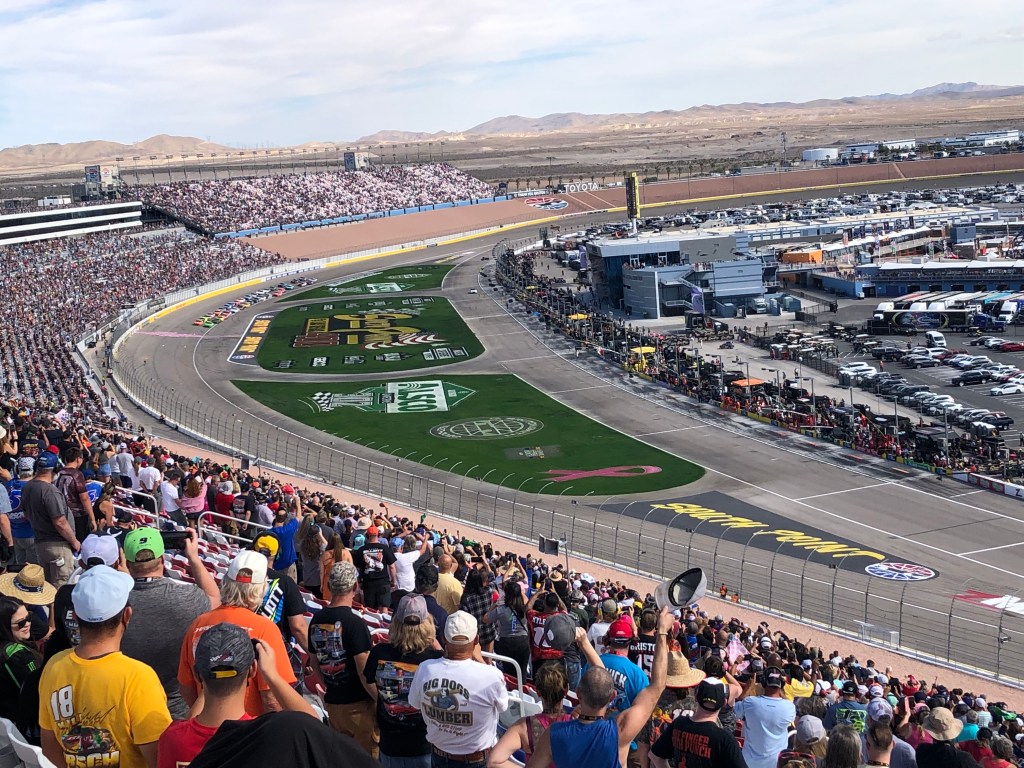
The Hitchin’ Post campground is located on North Las Vegas Blvd – 5 miles down the road from Las Vegas Speedway! Upon checking out the nearest bus stop for Doug to catch the bus, behold, a park nearby that was hosting a girls fastpitch tournament for the weekend! What a treat for me as Doug was treated to a NASCAR race.
Doug – On Sunday AM I caught a bus to within a couple of miles of the Speedway and then proceeded to walk there. As I was walking, I noticed that I was the only guy walking to the track. Along the way I say an old scruffy guy up ahead, with his garbage bags and dirty clothes looking for some shade in the hot morning sun. I gave him $5.00 for some breakfast. After walking further, I realized there was no place he was going to buy anything to eat so I turned back to give him my lunch, but he was out of sight. I got to the track with time to spare and proceeded to my seat. A good crowd on hand but enough empty seats that I could sit wherever I wanted. It was a good race but a little boring by myself. It became really hot and the walk back was hard. Along the way I saw the old guy and I turned to speak with him. There he was sitting on the curb counting his wad of cash! He looked hungry so I gave him my trail mix and thought yes, he was doing pretty good out there getting people to help him. Who knows, maybe he was an angel?
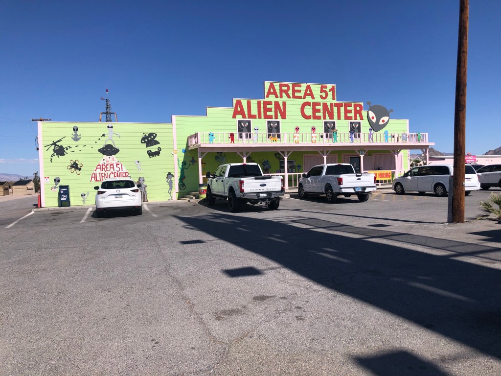
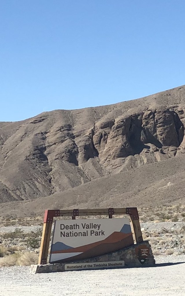
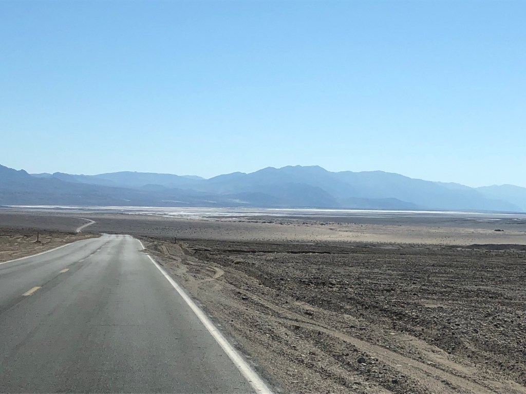
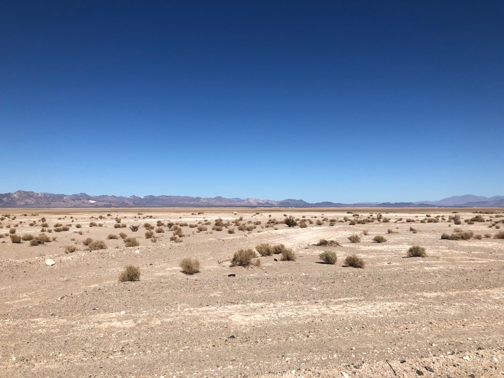
We headed south to Death Valley along Hwy 95 – a desolate valley hwy between the Spotted Range and Spring Mtns. At the intersection of Hwys 95 & 373 is a little spot named Amargosa Valley at the bottom of the Yucca Mtns. Just over those mtns and amongst various mountain ranges is the Nevada Test and Training Range – a Nevada National Security Site, also known as “Area 51”. That was a neat surprise. There is a gift shop with all things “Area 51” complete with a brothel! Death Valley Junction wasn’t far from there – a deserted town with run down houses and businesses. Then we descended 3000 ft into Death Valley. The place boasts the world’s hottest temperature ever recorded at 134 degrees F (56.7 C) in 1913, and the lowest elevation at -282 ft below sea level. On our descent we could see the valley floor before us – a vast piece of real estate that is boxed in on all sides: Amargosa and Panamint Range of Mtns on left and right and the Grapevine and Owlshead Mtns at either end.
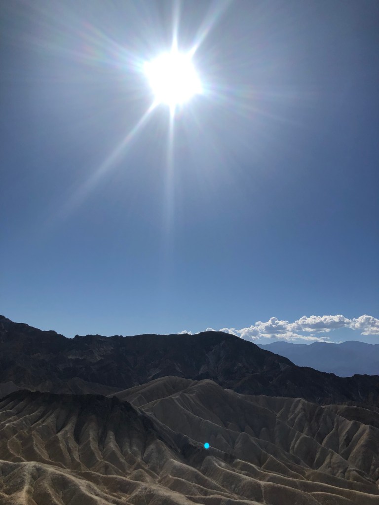
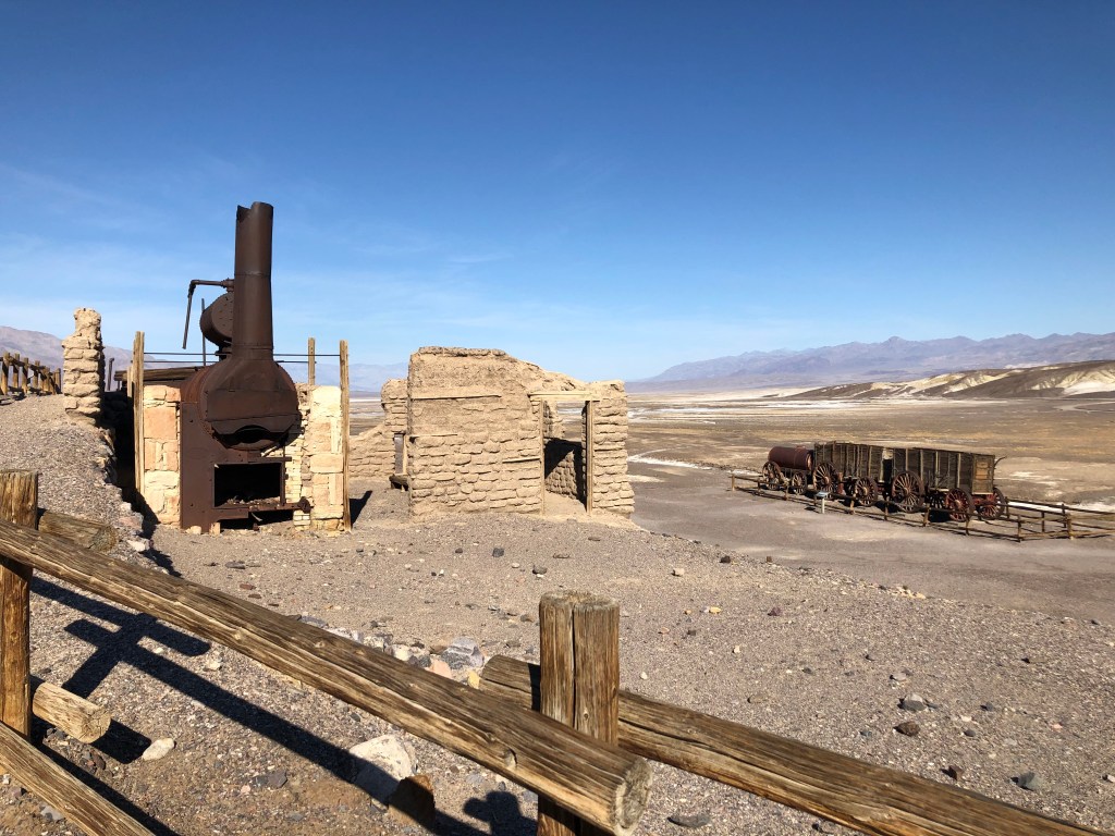
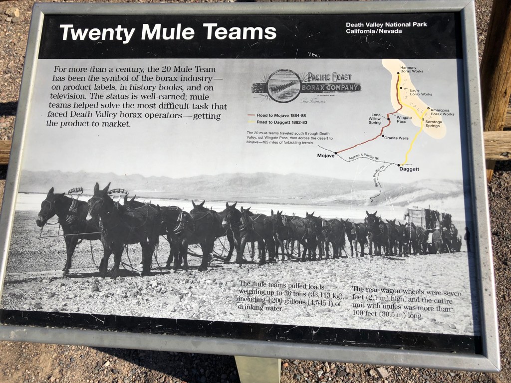
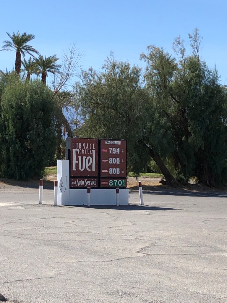
Our campground is aptly named Furnace Creek – it indeed was as hot as a furnace, but I failed to see any creek! I was surprised to see some vegetation, but it didn’t look very lively. Once the sun comes up it is instantly hot with the promise to get warmer. Needless to say, the landscape is quite desolate. I have seen pictures of the moon and Mars and anyone wanting to visit those locations don’t need to buy a ticket from Elon Musk – just visit Death Valley and save your money! Average rainfall is 2 inches/yr and in Aug 2022 75% of that fell at once resulting in flash floods that washed away and buried cars, stranding thousands of tourists. Many roads are still closed, so we weren’t able to see everything we wanted (Scotty’s Castle being one of them). The Harmony Borax Company started mining borax off the valley floor in 1881, using Japanese labourers at $1.30/day, less living expenses. 20 mule teams (ever wonder why the brand of borax is called 20 Mule Team?) transported the borax 165 miles away to the nearest RR depot in Mojave. Along with the borax they also hauled 1200 gallons of water.
The Timbisha Shoshone Tribe have been residents in Death Valley National Park for over 1000 years, having a deep connection to the land. Encounters with the white man since 1840’s has been a troublesome story. The Shoshone were pushed from their homes, denied access to water, and the land that fed them was being destroyed. In 1930’s the Federal Government built adobe houses for the small tribe. In 1960’s, after trying to evict the people by charging rent, denying them water access and electricity, their homes became dilapidated. The government then destroyed many using high powered water hoses. But the Shoshone are resilient and refused to leave. Rather, for over 60 years they fought to be recognised as a tribe and be granted land on which to live. In 1982 the tribe was given official status and they have land within the Valley. At last count they numbered around 125. The road to their village is closed to the public.
We left Death Valley early in the morning before it got too hot. The road is an upward drive for 30 miles. Death Valley was not my favorite place we visited – it is just too hot, at over 100 degrees F being normal temp. It’s redeeming feature is a wide-open night sky that we took in both nights we were there.
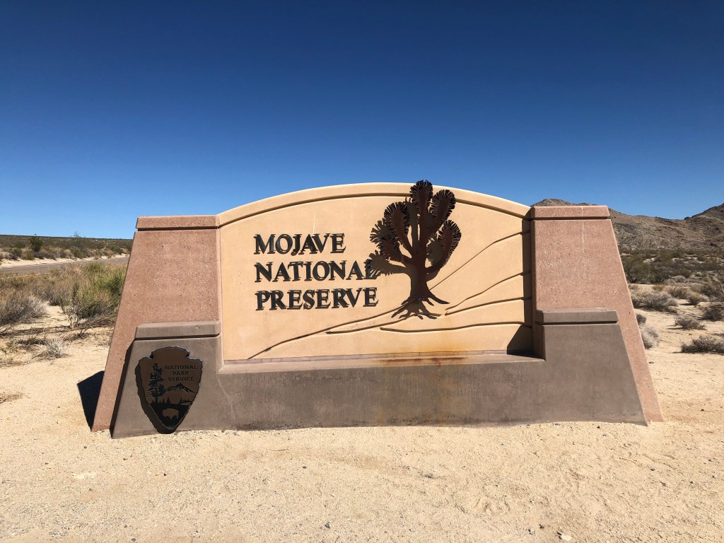
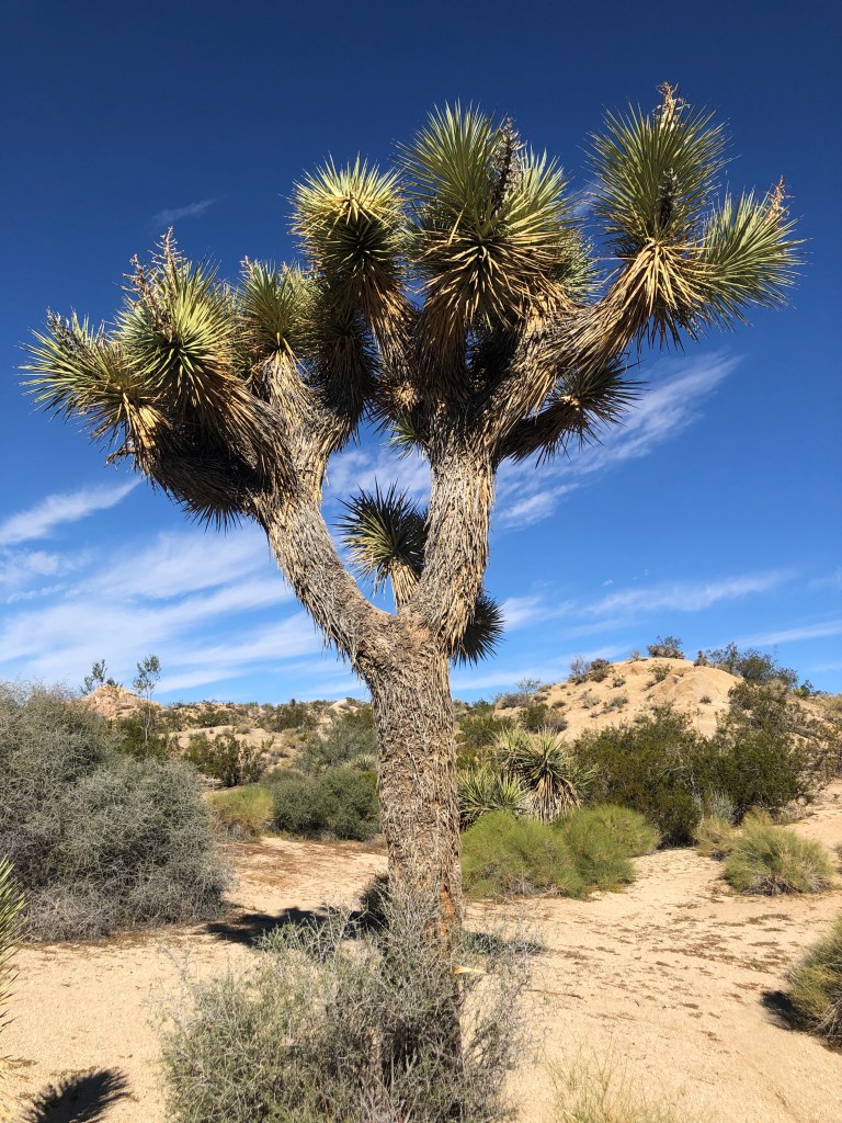
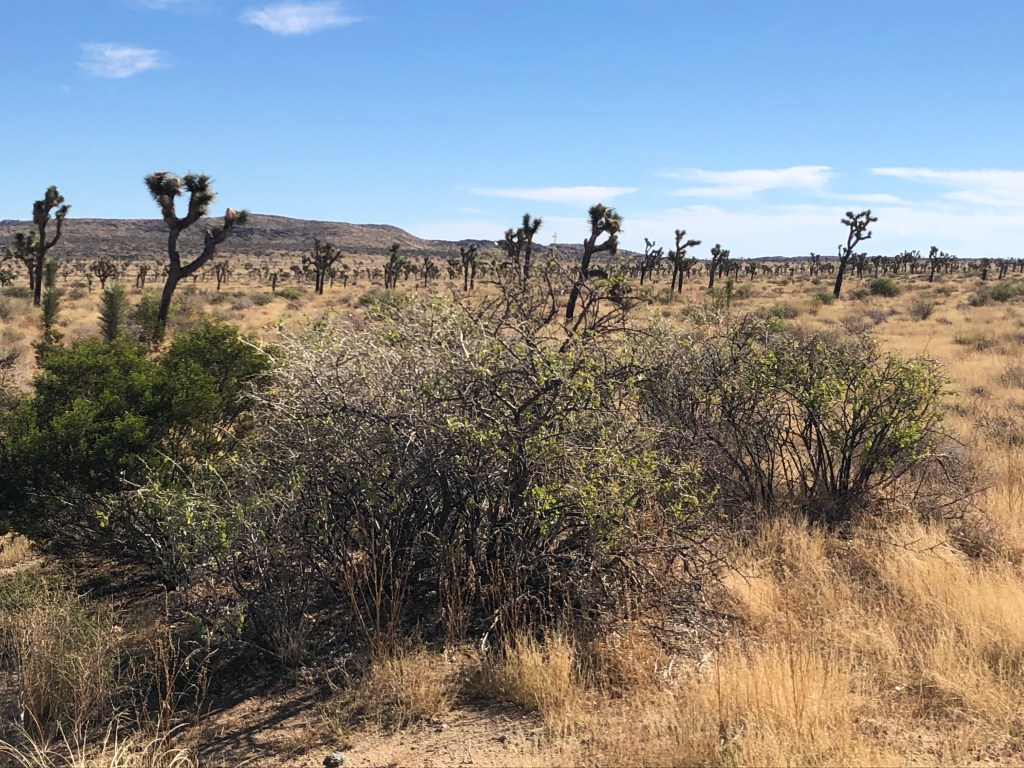
Our drive to the Mojave National Preserve had an unexpected detour because the road was washed out. Hwy 15 to the only other road through involved a climb to over 4700 ft. A sign on the hwy warned to turn off air conditioning to prevent the vehicle from overheating. The drive through the Preserve was stunning. At high elevations Joshua trees thrive – they are a curious shape; tall with branches going every which way having yucca type spikes on the ends. The Joshua trees we encountered at first looked diseased or burnt and dying. In August 2020 the Dome Fire burned 44,000 acres on Cima Dome, one of the densest Joshua tree forests in the world. Tree restoration is taking place but will take many years. The Preserve is 1.5+ million acres huge with elevations ranging from 880 ft at Baker to almost 7930 ft at Clark Mtn.
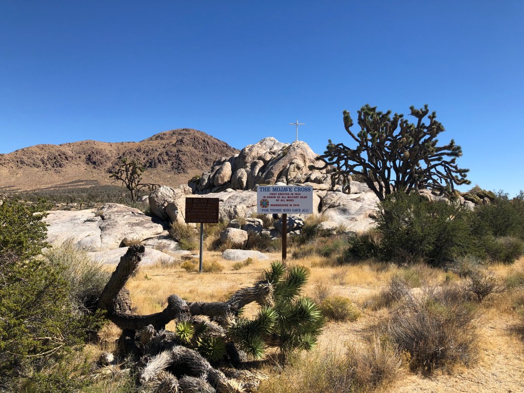
We came upon what is known as the White Cross WWI Memorial which is a cross embedded on Sunrise Rock. The original cross was erected in 1934 in honor of WWI fallen soldiers. Its history is a stormy one. In 2002 it was encased in plywood after court rulings decided it was illegal citing separation of church and state concerns (ACLU was involved). In April 2010 the US supreme court ruled there was no violation and in May the cross was stolen by a veteran who opposed it being erected on public land. Someone bolted a replica cross to the base of the original which was removed by the Park Service because it wasn’t the original cross (and you just can’t put stuff on public land!). For Sunrise Rock to remain as a memorial it was removed as part of the Preserve in April 2012 and is now owned by the California Office of the Veterans of Foreign Wars. After a 10 year battle, the original cross was found and rededicated in November 2012. What a waste of time and money by the ACLU, and for what.
The ghost towns of Cima and Kelso are along the way, but not all is lost – Kelso Dunes are a huge attraction for off-roaders. The dunes encompass 45 sq mi and reach heights of 650 ft. They mysteriously “sing” which is heard as a result of a gentle avalanche that is triggered by people as they descend the peaks of the dunes.
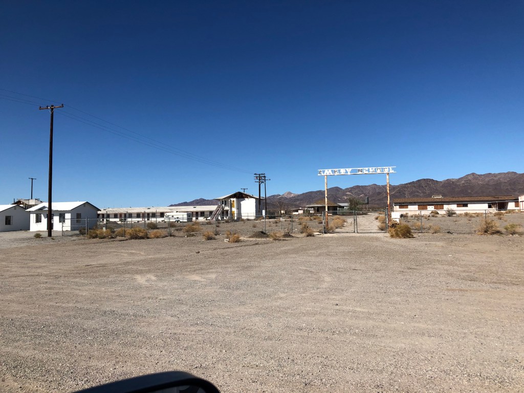
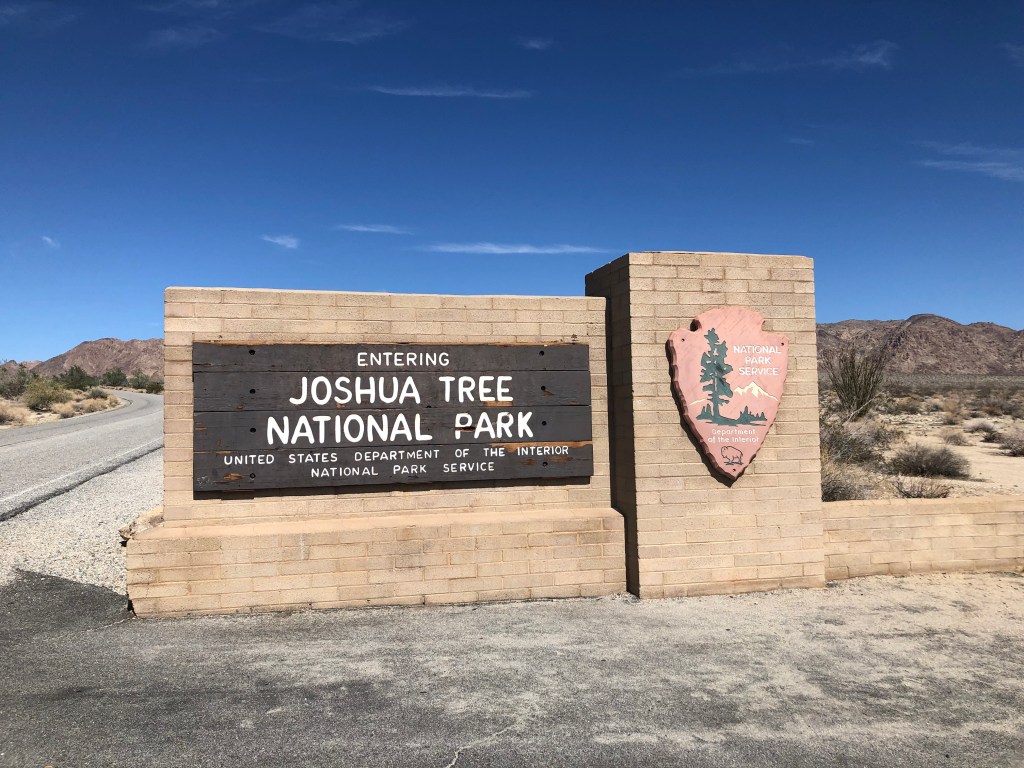
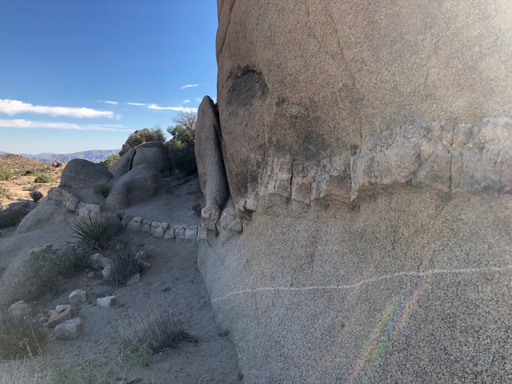
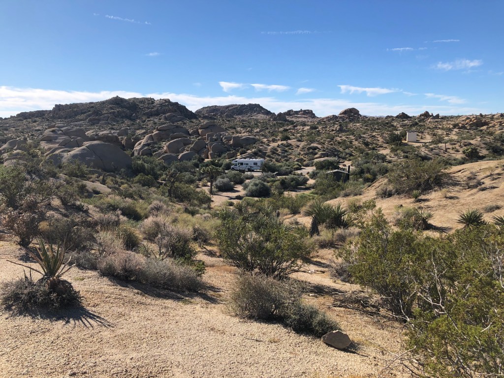
The surprises we encounter on our adventure are astounding. On our descent from the Preserve, we drove into Wonder Valley. It is south of Hwy 40 on the way to Route 66 loop (a portion of Route 66 between Ludlow and Essex CA). It is a sparsely populated community covering 150 sq mi made up mostly of artists, musicians and folks who originally wanted to live off the grid. Thousands of cabins and structures were built in the 50’s and 60’s and have since been left abandoned. Many are still occupied, and lots seem to have no power source (and it is very hot there). Along that section of Route 66 many bridges have been washed out and much of the road is closed. Amboy Crater is along there – a dormant volcano that rises 250 ft above a 27 sq mi lava field. Just down the road is Bristol Dry Lake where salt is mined. It was a full day of sightseeing amazing stuff and were happy to get to our campsite in Joshua Tree National Park among large, interesting rock formations at Jumbo Rocks Campground.
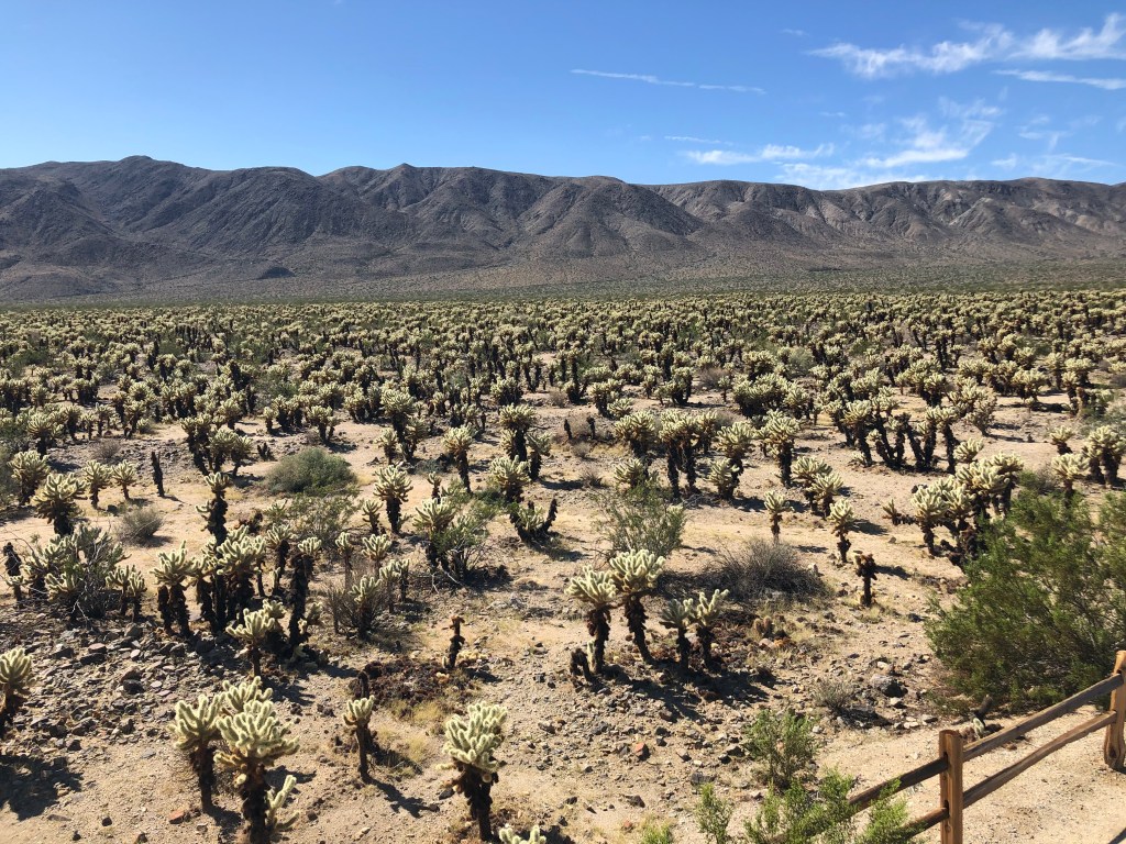
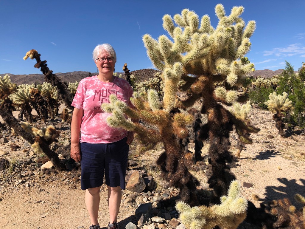
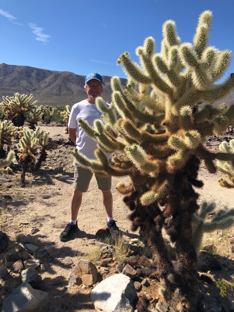
Joshua Tree NP is part of two deserts – the Mojave Desert, which is higher and cooler and where healthy Joshua trees abound, and the Colorado Desert 3000 ft below. It is in this lower desert that we saw the Cholla (choy-ah) Cactus Garden – nearly 10 acres of teddy bear cholla. A beautiful sight that we would love to behold in the Spring when the desert is blooming! Beyond the garden we could see the vast desert floor below. Joshua trees were unseen at this point.
We drove by the Salton Sea, a landlocked lake created over 100 years ago when the Colorado River overflowed and poured into a large valley in south-eastern California. It used to be a resort area but now is a toxic waste site – with no water flowing in or out it has become a huge problem. The government is under pressure to fix it but aren’t sure how.
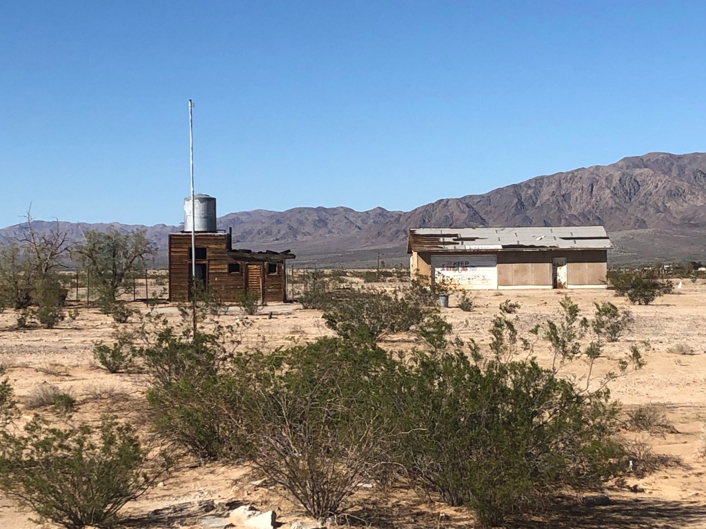
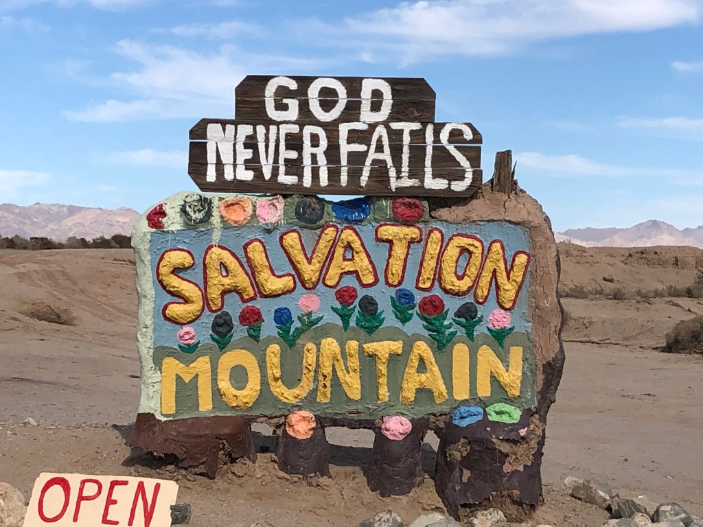
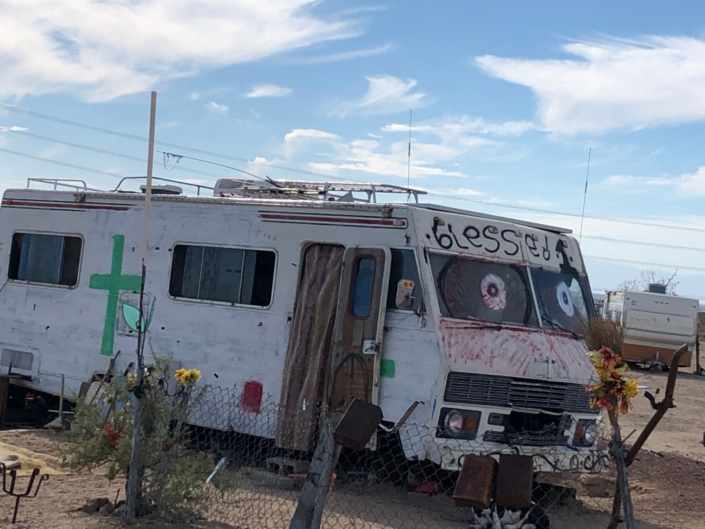
We made our way to Slab City where we planned to boondock for the night. It is a little piece of real estate just behind Niland CA. The road in is uncared for and so it goes for the community. US Military built the little town during WWII as a training place for marines. The buildings were torn down after the war leaving slabs where the buildings had been. Slab City is an unincorporated off-grid alternative community that is known for attracting people who want to live outside mainstream society. It looked like a garbage heap with its dilapidated buildings and trash everywhere. It didn’t give any sense that it was good sense to be there for even 30 seconds.
Within the community is Salvation Mountain – a strange piece of artwork that has a feel all its own. The artwork, created by Leonard Knight, is on the side of a huge stone hill and is made of adobe bricks, discarded tires, windows, auto parts and thousands of gallons of paint and is religious in nature. The Folk Art Society of America declared it a “folk art site worthy of preservation and protection.” Beauty is definitely in the eye of the beholder in this case! So, we spent our 30 seconds there and decided to get to Holtville, about an hour outside of Yuma AZ. The BLM there is pristine, beautiful, and vast with a hot spring beside it that averages temps of 102 – 105 degrees F.
Tomorrow – YUMA!